free web page builder

Lidar V-Hawk (Multi-Rotor)

V-Hawk 40 

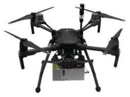
Posterra V-hawk 40 is a kind of light compact LiDAR point cloud data acquisition system, integrated V-Hawk 40 laser scanner, GNSS and IMU positioning and attitude determination system and storage control unit, and is able to real-time,dynamically, massively collect high-precision point cloud data and rich image information. It is widely used in the acquisition of 3D spatial information in surveying, electricity, forestry and land planning. 

  • High efficiency: Stand-alone daily survey about 150 hectare
  • High integration: Fully integration with DJI drone’s power, Point cloud data time synchronization, Point cloud data / POS data unified storage
  • System stability: Has been tested many hours for durability
  • Easy to operate: Support one-button process data collection, one-click take off and landing, automatically execute flight data
  • Real-time monitoring: Support point cloud data, POS parameters and real time display device status during opration.
V-Hawk 100
Posterra V-Hawk 100 is a light compact LiDAR point cloud data acquisition system, integrated laser scanner, GNSS and IMU positioning and attitude determination system, camera (optional) and storage control unit, is able to real-time, dynamically, massively collect high-precision point cloud data and rich image information. It is widely used in the acquisition of 3D spatial information in surveying, electricity, forestry, agriculture, land planning, geological disasters, mine safety.
  • High efficiency: Mapping accuracy met 1:1000, Stand-alone daily survey 2 square kilometers
  • High integration: Point cloud data time synchronization, Point cloud data / POS data unified storage, Simultaneous acquisition of image data
  • System stability: POS data double backup, accumulated safe operation time exceeds 8000 hours
  • Real-time monitoring: Support point cloud data, POS parameters, and real-time display device status during operation
Mobirise
V-Hawk 100H
Posterra V-Hawk 100H is a light compact LiDAR point cloud data acquisition system, integrated laser scanner, GNSS and IMU positioning and attitude determination system, camera (optional) and storage control unit, is able to real-time, dynamically, massively collect high-precision point cloud data and rich image information.
  • High efficiency: Mapping accuracy met 1:1000 / 1:500, Stand-alone daily survey 50 square kilometers
  • High integration: Point cloud data time synchronization, Point cloud data / POS data unified storage, Simultaneous acquisition of image data
  • System stability: POS data double backup
  • Easy to operate: Supports one-button process data collection, one-click take-off and landing, automatically execute flight route
  • Real-time monitoring: Support point cloud data, POS parameters, and real-time display device status during operation
Mobirise
V-Hawk 100M & 100C

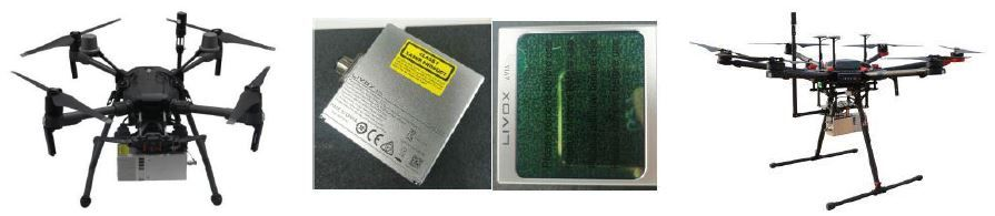
The V-Hawk 100M & 100C is a light compact LiDAR point cloud data acquisition system, integrated Livox new generation laser scanner, GNSS and IMU positioning and attitude determination system and storage control unit, is able to real-time,dynamically, massively collect high-precision point cloud data and rich image information.

It is widely used in the acquisition of 3D spatial information in surveying, electricity, forestry and land planning.

Mobirise
  • Low cost: With the help of DJI sensors, a laser scanning system of ten thousands USD has been realized
  • High effeciency: Standalone daily survey 6 square kilometers
  • High intergration: Point cloud data time synchronization, Point cloud data / POS data unified storage, Simultaneous acquisition of image data
  • System stability: Safe operating time of over 8000 hours
  • Easy to operate: Support one-button process data collection, on-click take-off & landing, automatically execute flight route
  • Real-time monitoring: Support point cloud data, POS parameters, and real time display status during operation
V-Hawk 260H

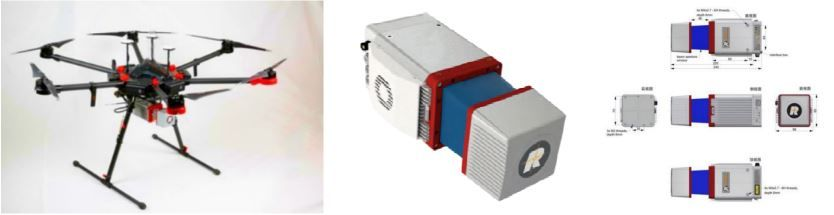
Posterra V-Hawk 260H is a kind of light compact LiDAR point cloud data acquisition system, integrated laser scanner, GNSS and IMU positioning and attitude determination system, camera (optional) and storage control unit, is able to real-time, dynamically, massively collect high-precision point cloud data and rich image information.

It is widely used in the acquisition of 3D spatial information in surveying, electricity, forestry, agriculture, land planning, geological disasters, mine safety.

  • High efficiency: Mapping accuracy met 1:1000 / 1:500, Stand-alone daily survey 50 square kilometers
  • High integration: Point cloud data time synchronization, Point cloud data / POS data unified storage, Simultaneous acquisition of image data
  • System stability: POS data double backup
  • Easy to operate: Supports one-button process data collection, one-click take-off and landing, automatically execute flight route
  • Real-time monitoring: Support point cloud data, POS parameters, and real-time display device status during operation
V-Hawk 260R
Posterra V-Hawk 260R is a light compact LiDAR point cloud data acquisition system, integrated laser scanner, GNSS and IMU positioning and attitude determination system, camera (optional) and storage control unit, is able to real-time, dynamically, massively collect high-precision point cloud data and rich image information. It is widely used in the acquisition of 3D spatial information in surveying, electricity, forestry, agriculture, land planning, geological disasters, mine safety.
Mobirise
  • High efficiency: Stand-alone daily survey 50 square kilometers, Mapping accuracy met 1:1000 / 1:500
  • High integration: Point cloud data time synchronization, Point cloud data / POS data unified storage, Simultaneous acquisition of image data
  • System stability: POS data double backup
  • Easy to operate: Supports one-button process data collection, one-click take-off and landing, automatically execute flight route
  • Real-time monitoring: Support point cloud data, POS parameters, and real-time display device status during operation
V-Hawk 260S
Posterra V-Hawk 260S is a kind of light compact LiDAR point cloud data acquisition system, integrated laser scanner, GNSS and IMU positioning and attitude determination system, camera (optional) and storage control unit, is able to real-time, dynamically, massively collect high-precision point cloud data and rich image information. It is widely used in the acquisition of 3D spatial information in surveying, electricity, forestry, agriculture, land planning, geological disasters, mine safety.
Mobirise
  • High efficiency: Mapping accuracy met 1:1000 / 1:500, Stand-alone daily survey 50 square kilometers
  • High integration: Point cloud data time synchronization, Point cloud data / POS data unified storage, Simultaneous acquisition of image data
  • System stability: POS data double backup
  • Easy to operate: Supports one-button process data collection, one-click take-off and landing, automatically execute flight route
  • Real-time monitoring: Support point cloud data, POS parameters, and real-time display device status during operation
V-Hawk 920

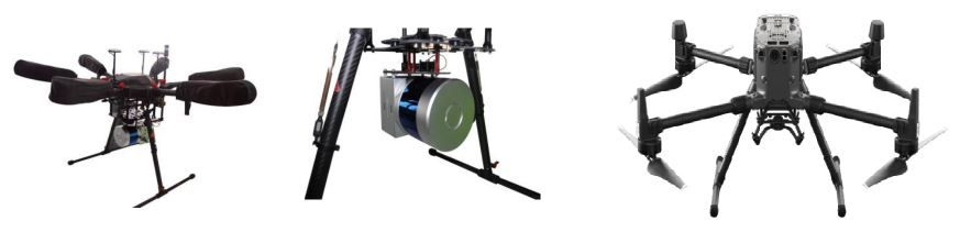
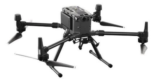
Posterra V-Hawk 920 is a long-range compact LiDAR point cloud data acquisition system, integrated long-rang laser scanner, GNSS and IMU positioning and attitude determination system, camera (optional) and storage control unit, is able to real-time, dynamically, massively collect high-precision point cloud data and rich image information.

It is widely used in the acquisition of 3D spatial information in surveying, electricity, forestry, agriculture, land planning, geological disasters, mine safety.

Mobirise
  • High efficiency: Mapping accuracy met 1:1000 / 1:500, Stand-alone daily survey 500 square kilometers
  • High integration: Point cloud data time synchronization, Point cloud data / POS data unified storage, Simultaneous acquisition of image data
  • System stability: POS data double backup
  • Easy to operate: Supports one-button process data collection, one-click take-off and landing, automatically execute flight route
  • Real-time monitoring: Support point cloud data, POS parameters, and real-time display device status during operation

Address
THE SURVEY SHOP (MYS) SDN BHD

The Intermark Tower, Kuala Lumpur, Malaysia

181, Jalann Tan Sri Ong Kee Hui
93300 Kuchiing Sarawak


Contacts

Email: thesurveyshop@gmail.com                     

Links

Old Web Link 
Download for Windows


Feedback

Please send us your ideas, bug reports, suggestions! Any feedback would be appreciated.

SHARE THIS PAGE!