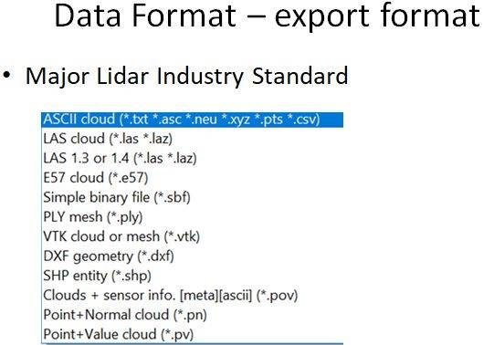
free web software

Post Terra Cloud

Post Terra Solution

Our system design and workflow is based on 30 years of in-depth survey experience and we understand how the system will be used in practice.

The workflow enables you to: 

  • Undertake rigorous survey planning
  • Easy deployment in the field
  • Quality Assurance of data
  • Quick download of data
  • Filtering of data in LidarViewer Pro to extract the specific data needed
  • Export to third party packages

Workflow To Increase Your Rate Of Return

The Post Terra workflow brings efficiency, effective management, improves productivity and results in a high rate of return or cost saving.

Mobirise

Lidar Base Module

  • For Lidar Processing
  • Fly log trajectory processing
  • GPS PPK post processing
  • Output to Lidar LAS raw or ascii only
Mobirise

For UAV FLY GPS PPK and PPS

Mobirise

For Synchronize LIDAR, POS and Camera
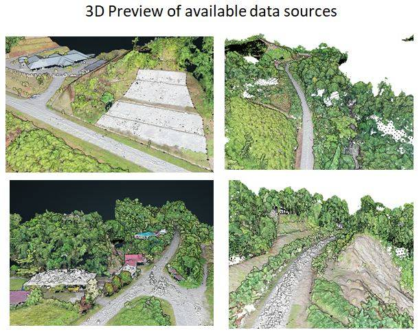
Cloud Mapper

  • For Lidar/UAV cloud data advance Processing and editing
  • Engineering Process such DSM, DTM, Classification, contouring and etc
  • Various analysis and advance module
  • Export to various industry standard
Mobirise

Ready Tool to classify ground

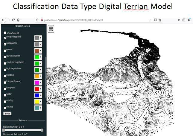
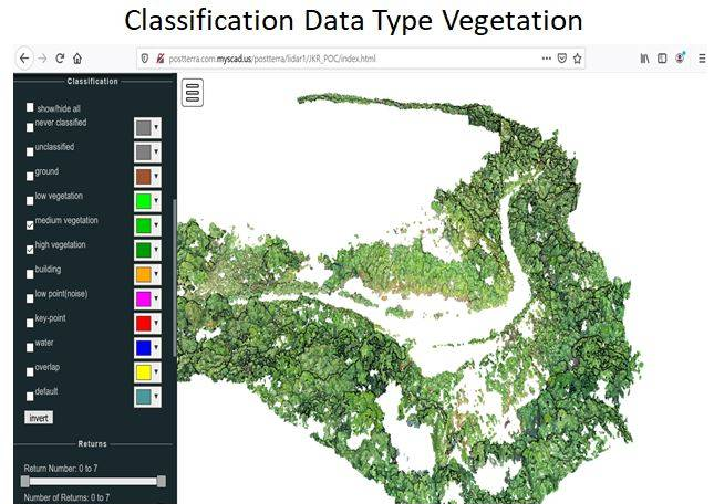
Vegetation layers, buildings etc. Check ground classification with the help of Post terra Web Cloud. 

Mobirise

You can produce different deliverables 

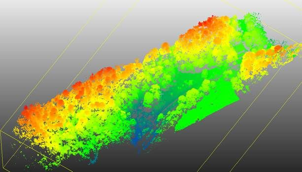
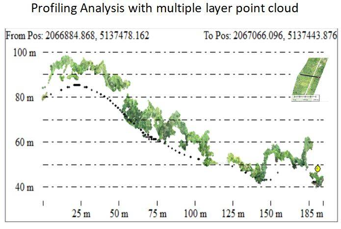
                   From the classified point cloud. For example: DTM. 

Mobirise

Match & merged

Multiple flight/drive passes and automatically find tie lines. Cut the overlap. Tie the point clouds to ground reference points. 

Mobirise

Support data

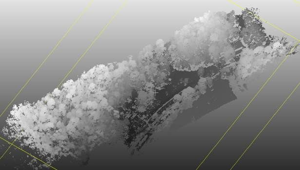
From various Lidar sensor & UAV LAS data Import processed laser points and trajectories. Filter low points, stops and other error points. Deduce line numbers to points.

Mobirise

Colourised lidar module

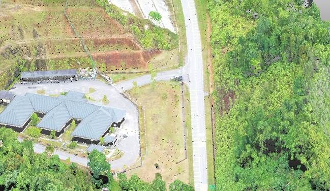
You can create a RGB lidar cloud with true ortho mosaic from the raw images. You can also automatically texturize building walls using oblique images and colorize both airborne and mobile point clouds using images.

Mobirise

Contouring & volume

   Automatically produce contours with full user definable parameters.

Mobirise

Lidar Terrain Data feature

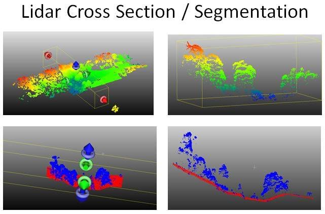
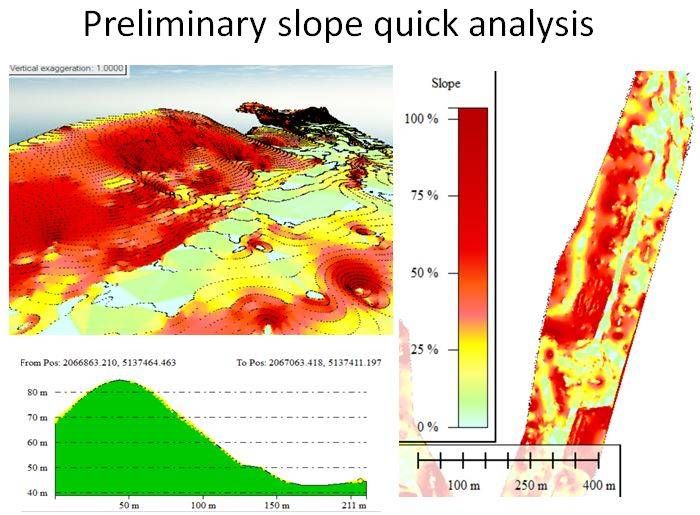
The terrain model provides a series of automatic and manual-editing tools for classifying ground points from LiDAR point clouds. It also provides a set of GIS tools for interpolating surface models (e.g., digital elevation model/DEM, digital surface model/DSM), and visualizing and editing them in 3D. Additionally, it contains tools for repairing surface models from spikes and holes. Furthermore, It allows users to analyze the terrain model to generate derivatives from the surface
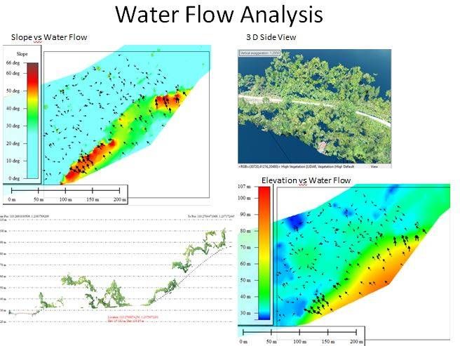
models, e.g. slope, aspect, and roughness. 

Post Terra Cloud - Web Module

  • For data web sharing
  • Web base digitising
  • Data exporting to LAS or DXF via web browser
  • Slope and profile analysis
  • Automation reprogram your lidar data to *.html format
  • Store in your own server
  • Online analysis, survey and digitising
  • Reexport your data in CAD or LAS via web browser
  • Sharing your lidar data any time any where

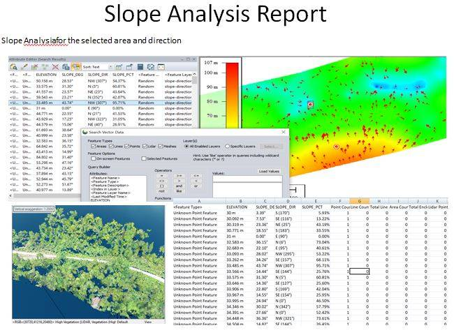
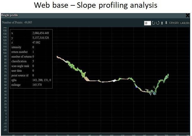
Web Base Slope Analysis feature:

  • Classification Ready for all data type
  • Classify Selected Lidar Points for following data : Ground, Vegetation Low, Vegetation Medium, Vegetation High, Building, High Noise, Model Key-point, Etc 
  • User can do the webbase query, survey, measure, analysis on screen for the selected Lidar or cloud data.

Web Base Cloud html - Justification

  • Inter division or government data sharing
  • All data survey and capturing to online web base
  • Government cost saving on re survey of existing road.
  • Other agency can resurvey via digitizing on screen on their area of interest via web and download to their own software for further analysis via web.
  • Beneficial for big cooperate and government agency
  • No special skill needed to access the data via online web browser.
  • No specialized software or super computer needed for other agency.

Platform independent

All online platform support.
Windows base, rinux, apple or android.
Any platform that can online.

Hardware independent

Normal PC. 
Tablet. 
Smart phone. 
As long as can online. 

Software independent

No special software or skill needed.
Can be run on common web browser: Google Chrome, Mozilla, Internet Explorer, Microsoft Edge etc

Address
THE SURVEY SHOP (MYS) SDN BHD

The Intermark Tower, Kuala Lumpur, Malaysia

181, Jalann Tan Sri Ong Kee Hui
93300 Kuchiing Sarawak


Contacts

Email: thesurveyshop@gmail.com                     

Links

Old Web Link 
Download for Windows


Feedback

Please send us your ideas, bug reports, suggestions! Any feedback would be appreciated.

SHARE THIS PAGE!